
Drone documentation has moved from novelty to operational tool in property claims over the past few years. For emergency roof tarping specifically, aerial imagery can sharpen a claim file considerably, but it can also add cost and complexity without proportional value. Knowing the difference matters for adjusters, vendor managers, and TPAs who are trying to run efficient operations.
When Aerial Imagery Actually Helps a Tarping Claim
The strongest use case for drone documentation in tarping is pre-installation roof condition capture. A drone can photograph the full roof plane in a single pass, showing existing damage, prior repairs, and the scope of the affected area before any mitigation crew touches the surface. That baseline matters when coverage disputes arise later.
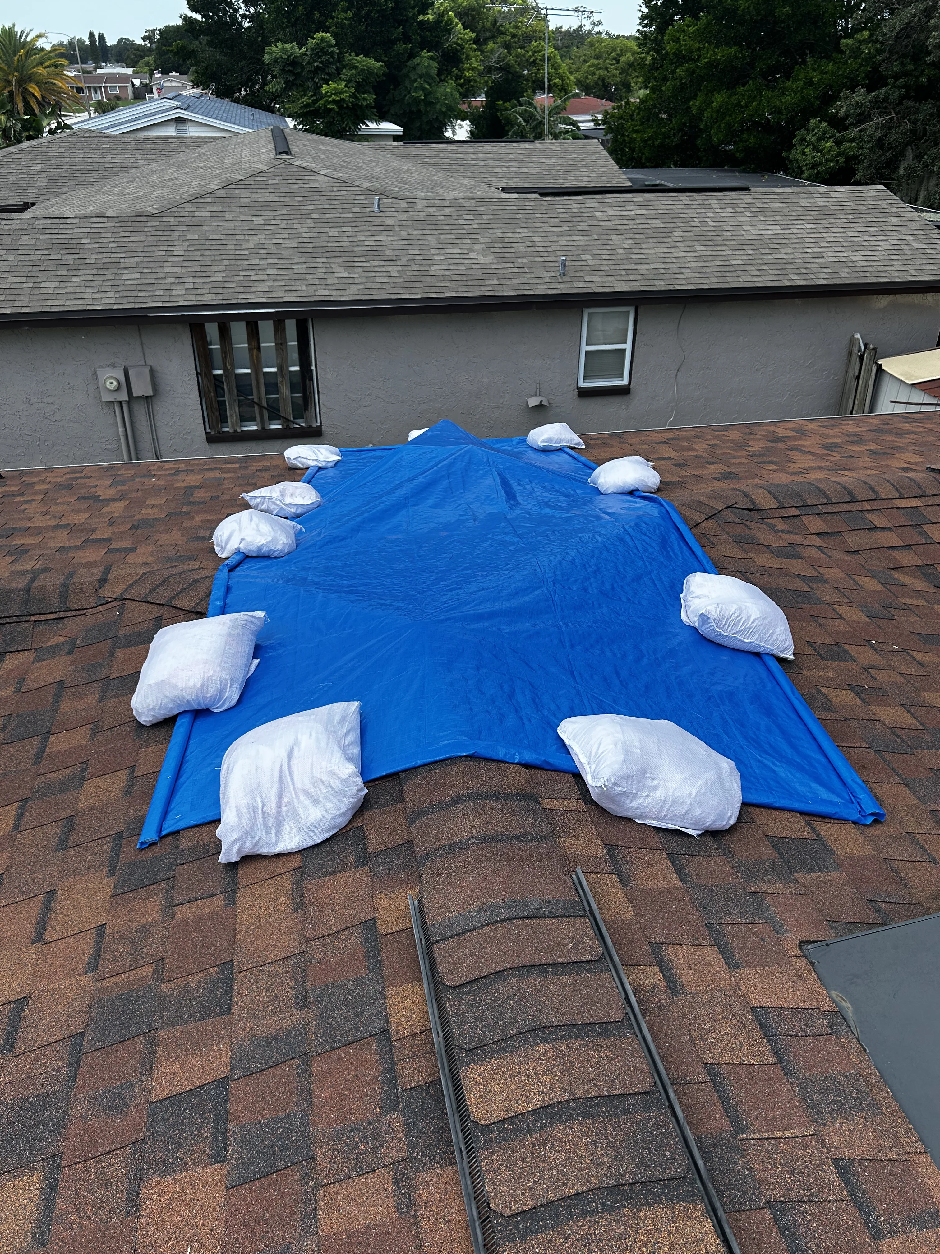
Post-installation, aerial imagery confirms tarp placement, coverage area, and perimeter securement in a way that ground-level photos simply cannot. A well-framed overhead shot showing the tarp edge-to-ridge alignment, ballast bag placement, and drip-edge clearance gives a carrier's field reviewer everything they need to approve the scope without a second site visit.
For larger commercial losses, drone documentation can also support accurate square footage calculations. When a tarp covers 4,000 square feet of a low-slope membrane roof, an aerial measurement cross-referenced against the contractor's scope sheet is a meaningful quality check.
When Drone Photos Add Cost Without Value
Not every tarping job warrants aerial documentation. On a standard residential loss, a 1,500-square-foot gable roof with a single tarp section, ground-level photos from four angles plus a ridge shot from a ladder typically capture everything a claim file needs. Adding a drone flight to that job increases mobilization time and cost without improving the documentation quality.
There's also a practical timing issue. Emergency tarping is, by definition, time-sensitive. A crew responding within 24 hours of a storm event may be working in conditions, at dusk, or in a sequence where drone operations aren't practical. Requiring aerial documentation as a standard line item on every tarping assignment can slow response and create friction with crews who are trying to protect the property quickly.
The better approach is to treat drone documentation as a conditional requirement based on roof complexity, loss size, and coverage exposure, not as a blanket policy.
FAA Part 107 and Operational Compliance
Any commercial drone operation in the US requires a licensed pilot under FAA Part 107. That means the person flying the drone must hold a Remote Pilot Certificate, not just a consumer drone and a phone. When you're reviewing a vendor's documentation package, it's worth confirming that aerial imagery was captured by a compliant operator.
This matters for two reasons. First, imagery captured by an unlicensed operator in a controlled airspace or near an airport could create liability exposure. Second, Part 107 compliance is a reasonable proxy for operational professionalism. A vendor who invests in licensed pilots and proper equipment is generally running a tighter operation overall.
TarpBags® crews who incorporate drone documentation work with Part 107-certified operators and follow standard pre-flight checklists that include airspace authorization checks. That documentation is available to carriers on request.
What Good Aerial Documentation Looks Like
A useful drone photo package for a tarping claim includes a few specific elements. You want a nadir (straight-down) shot of the full roof showing the tarp in context, at least two oblique angles showing the perimeter securement, and a close-up of any penetrations or valleys where the tarp transitions. If there are multiple tarp sections, each section should have its own coverage shot.
The images should be geotagged and timestamped. Geotags confirm the photos were taken at the loss address, not pulled from a library. Timestamps establish the documentation sequence relative to the installation. Both are standard outputs from any professional drone platform.
PLRB resources on documentation standards offer additional guidance on what carriers expect in a well-documented claim file, including photo requirements for mitigation work.
Integrating Drone Data with Estimating Platforms
Aerial imagery integrates well with both Xactimate and Symbility workflows. In Xactimate, drone-derived measurements can be imported directly through the sketch tool, reducing manual entry errors on complex roof geometries. Symbility's mobile platform supports photo attachment at the line-item level, so aerial shots can be linked directly to the tarp scope line rather than sitting in a general photo folder.
For adjusters working in either platform, the practical benefit is a tighter connection between the visual documentation and the scope. When a reviewer questions a line item, the supporting photo is one click away rather than buried in a 200-image folder.
TarpBags non-destructive installation method also means the roof surface captured in aerial photos remains intact. There's no nail penetration pattern to explain, no secondary damage to document. The aerial record shows the tarp as installed, and the underlying roof as it was before the crew arrived.
For questions about documentation standards or to discuss how TarpBags handles aerial documentation on larger losses, call (833) 365-TARP or visit our insurance vendor partnerships page.
Partner With Tarpers
Whether you are an insurance carrier, a TPA, or an adjuster looking for reliable non-destructive tarping vendors, we are here to help. Get in touch with our team.